Great hike today. We (myself, Ken, Mark and Greg) ventured down south to Mount Rainier National Park to hike to Upper Crystal Lake. The hike itself was relatively moderate, a nice consistent grade almost the entire way on a good trail but the location and the views were first-rate.
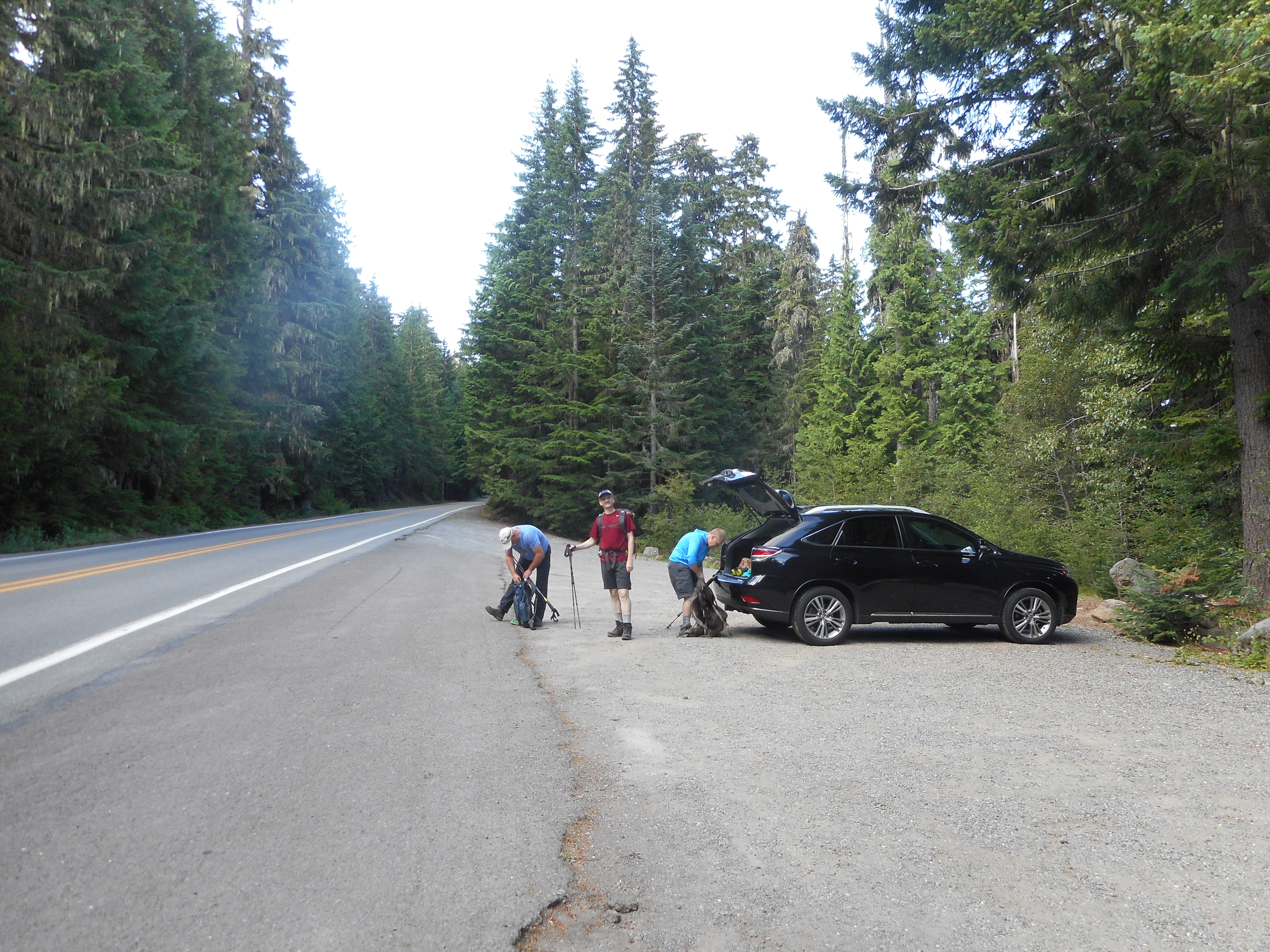
We parked on the side of Highway 410 and crossed the street to the trail head:
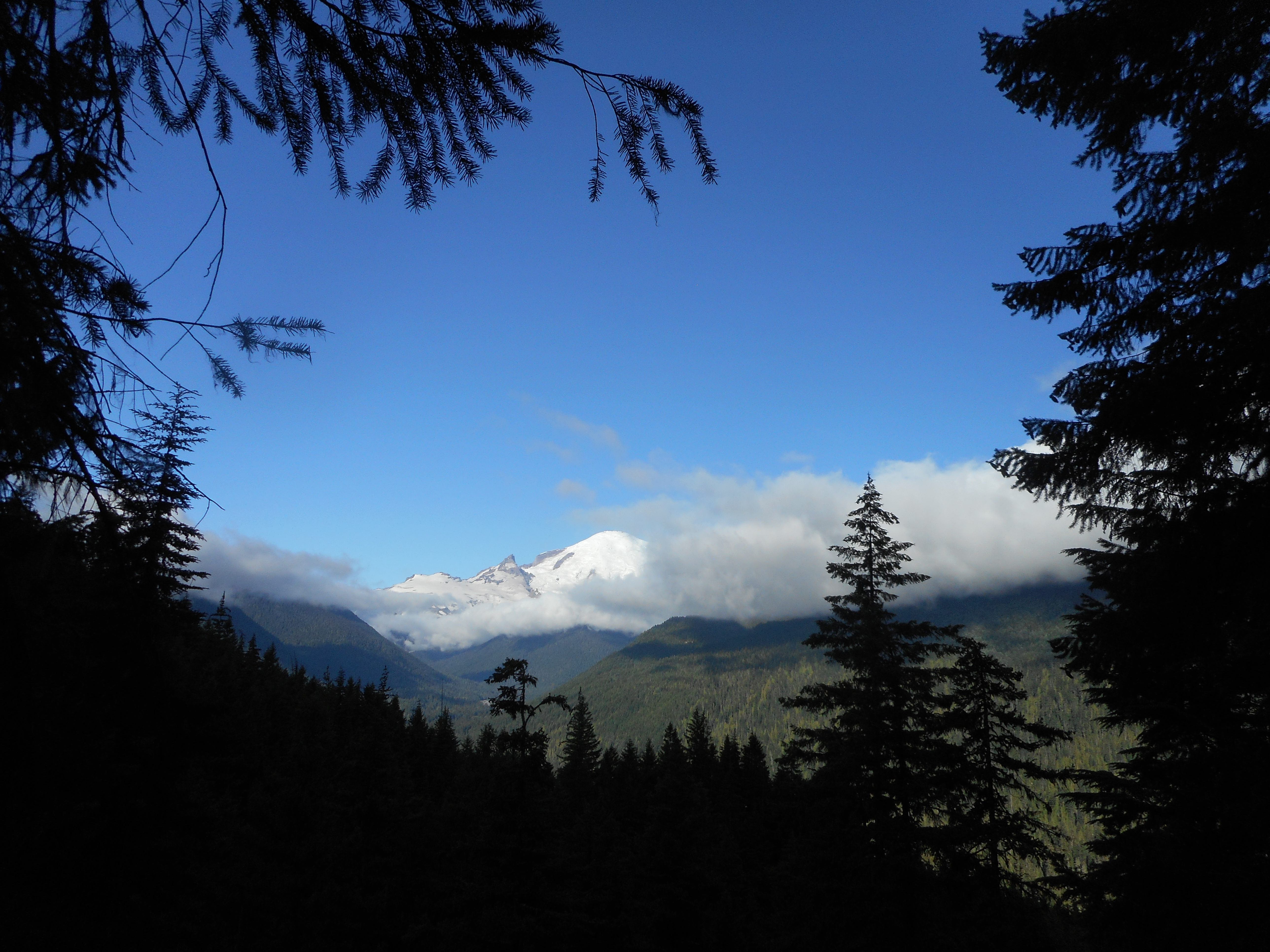
Not too far up the trail there was a break in the trees and we could see the nearby Mt. Rainier:
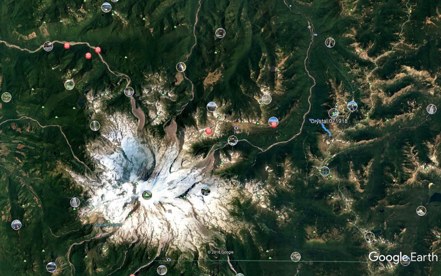
Here is a view from way overhead, via Google Earth, of our proximity to Rainier. Our track is the little blue squiggle on the right; Rainier is pretty obvious:
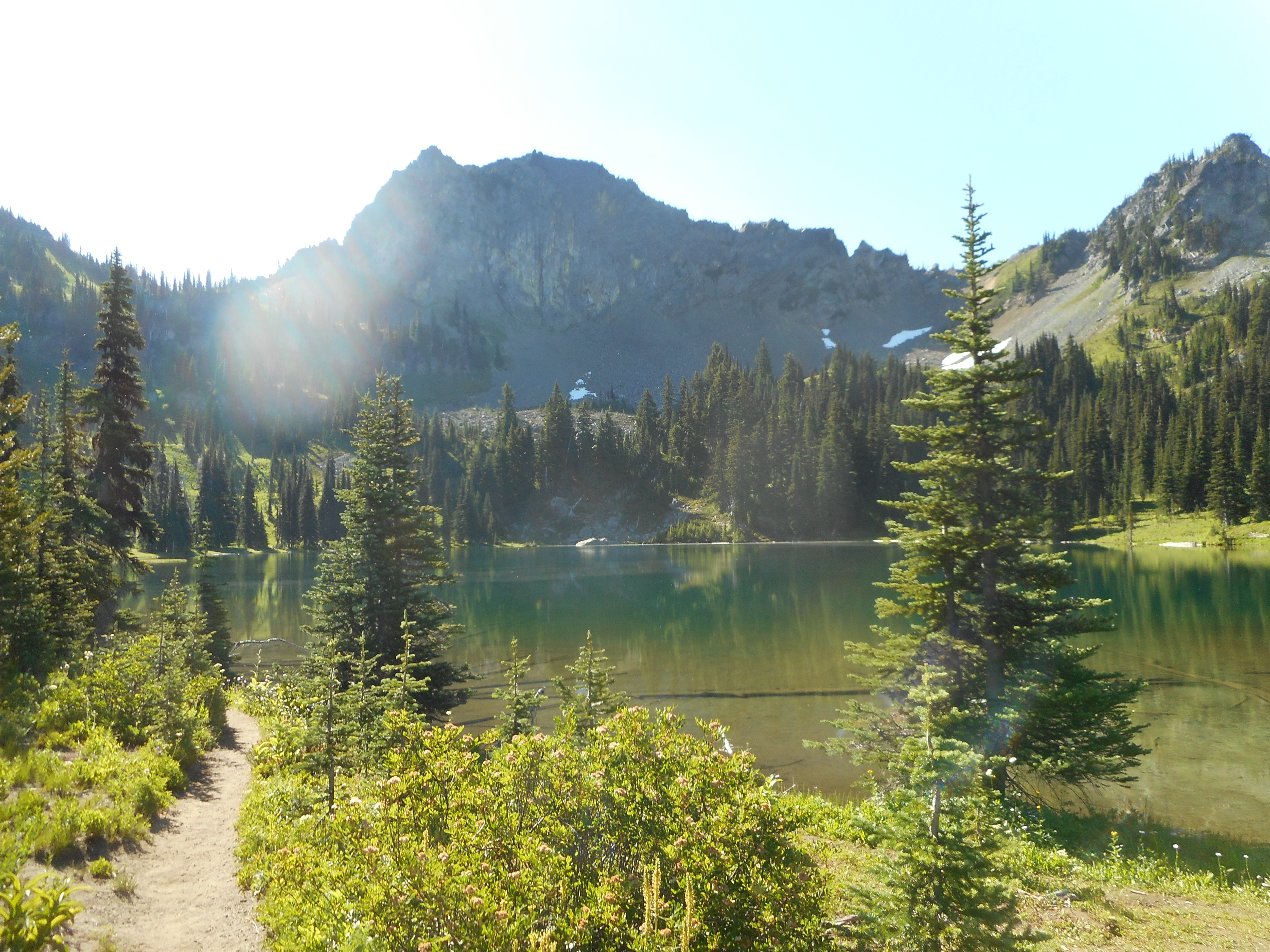
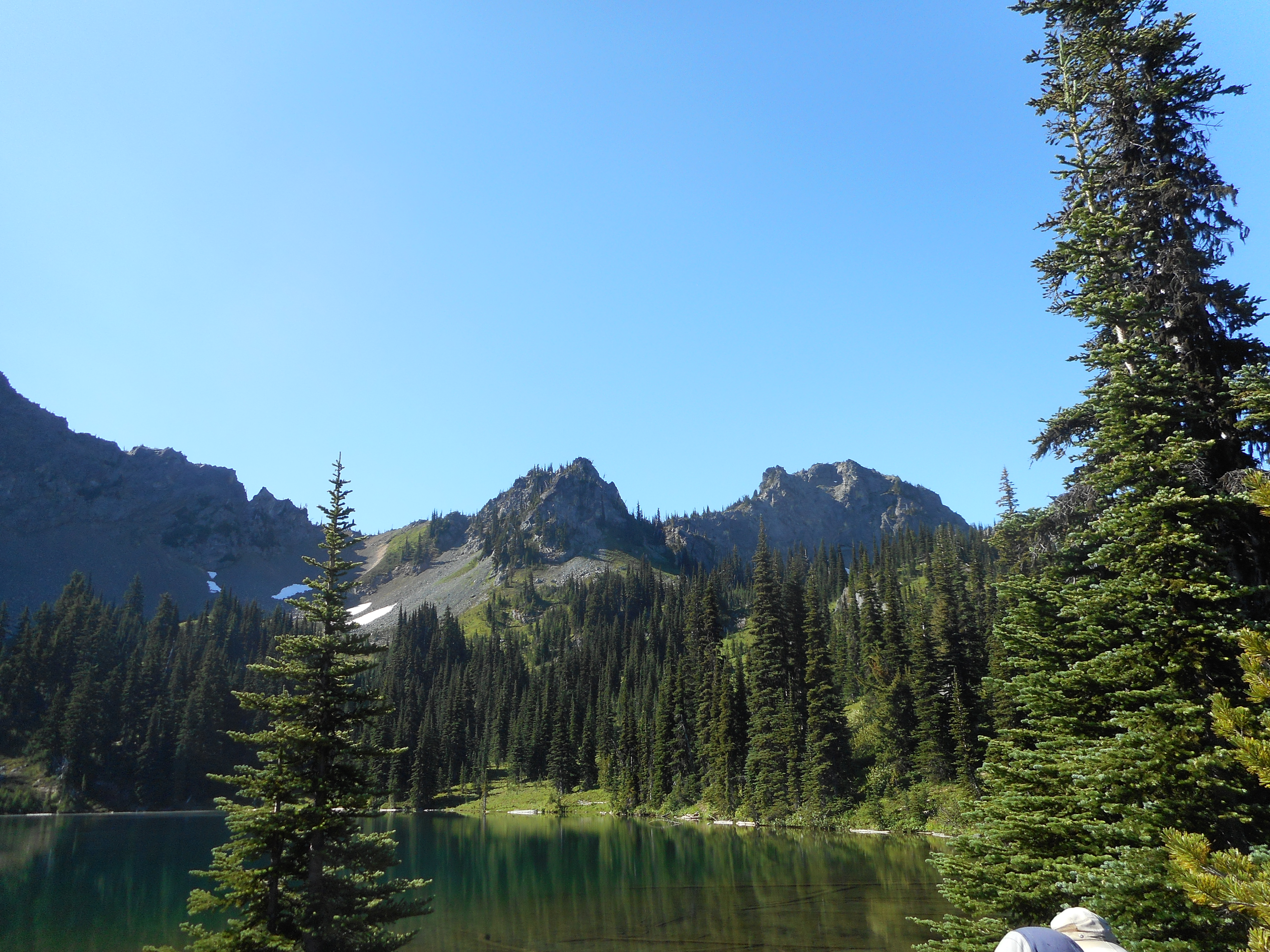
Crystal Lake sits in a basin surrounded by very impressive mountains:
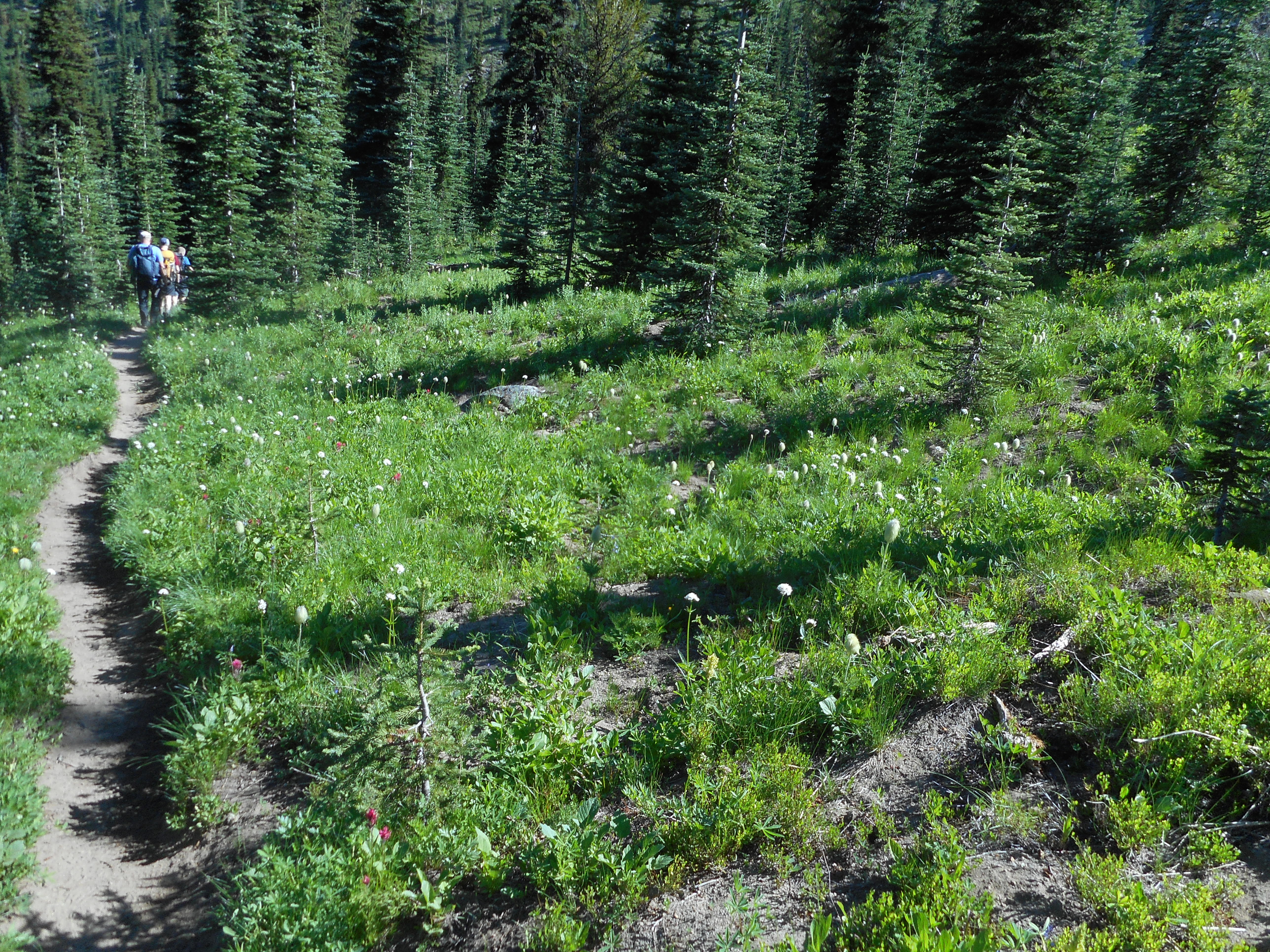
Just below the lake is another one of those beautiful mountain meadows:
We were up pretty high, in the neighborhood of 5,800 feet +. Here is what our track looks like on Google Earth:
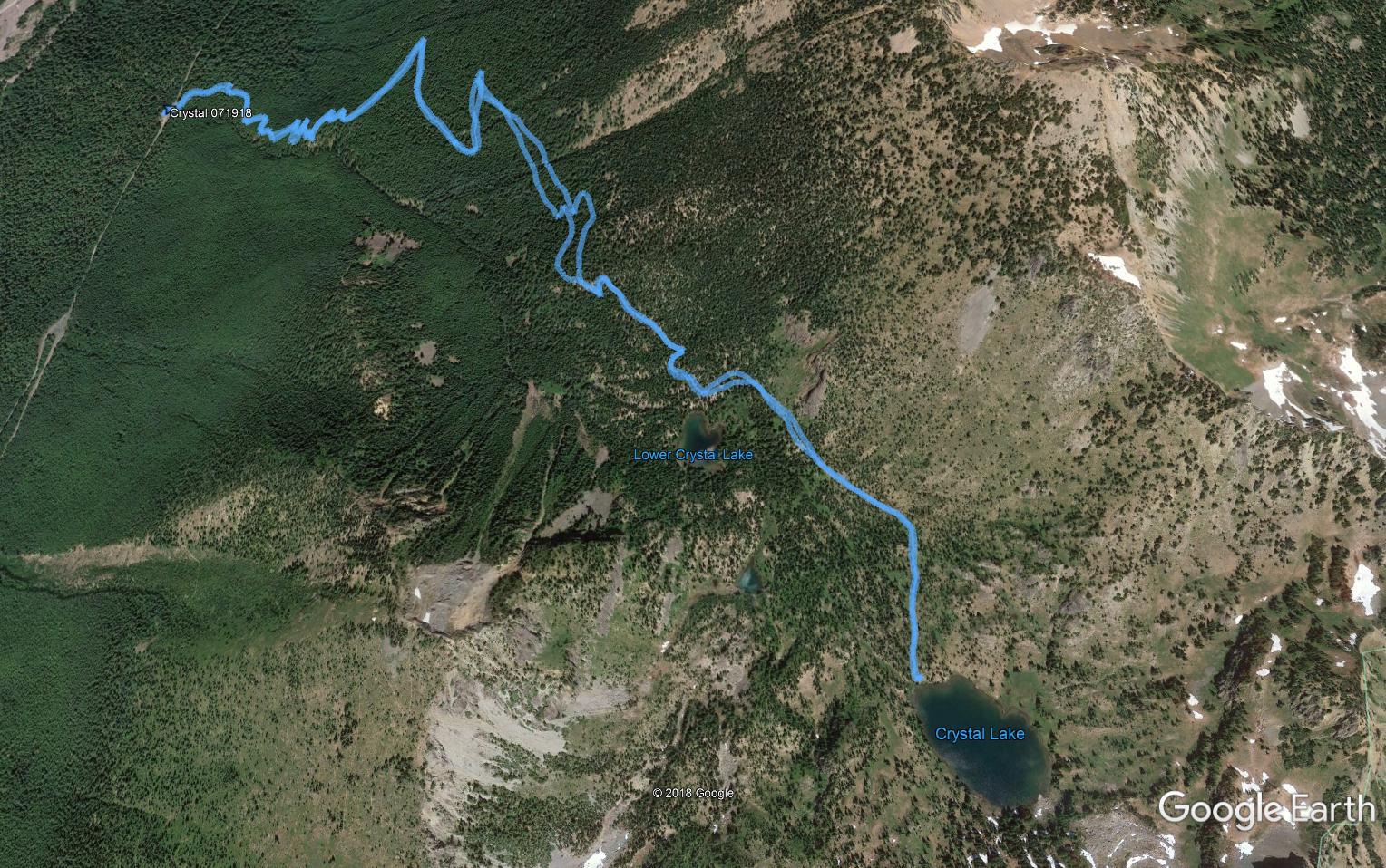
According to my Garmin the hike was 5.84 miles with 2,263 feet of elevation gain. Fairly moderate but an outstanding hike nevertheless.
Beautiful!